
We evaluate how effectively Clarity surfaces mineral targets, subtle anomalies, and difficult signatures conventional imagery may miss.
Target maps and mineral layers are delivered with supporting mineral signals, anomaly context, and analyst-ready review detail.
Evaluations are scoped around the mineral target, available data, and the drill-prioritization or ground-follow-up decision your team needs to make.
Why Clarity
1Rare Target Detection
Clarity’s spectral models can detect mineral signatures using minimal training data, enabling targeting of rare deposits even when field samples are scarce.
2Explainable Targeting
Every prediction includes spectral traceability so geologists can understand exactly why a location was flagged.
3Large‑Scale Analysis
Analyze massive hyperspectral datasets across entire regions without building specialized internal infrastructure.
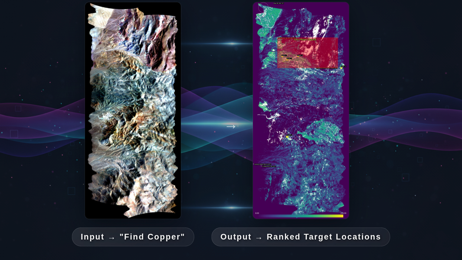
Example output: a customer-safe target prioritization map or mineral class layer with anomaly zones, supporting mineral signatures, and an analyst-ready summary tied to the area of interest.
Request a Customer-Safe ExampleProject Scoping Process
From initial target to rapid proof-of-value.
1. Define Target
Identify the mineral, compound, or geochemical signature of interest.
2. Assess Data
Evaluate existing datasets or procure hyperspectral imagery through Clarity’s satellite integrations.
3. Rapid Proof of Value
Deploy spectral detection models and generate exploration maps highlighting high‑probability targets.
Questions Buyers Ask Before They Scope an Evaluation
What data sources do you support?
Evaluations can be scoped around hyperspectral satellite, airborne, drone, and customer-provided imagery, including familiar sensors such as PRISMA, EnMAP, and EMIT where relevant.
What does an evaluation deliver?
A package with a target prioritization map or mineral class layer, spectral context, anomaly review cues, and a decision-ready summary tied to the exploration objective.
How is success judged?
Success can include rare or hidden target detection, target prioritization quality, analyst time saved, decision usefulness, output quality, and workflow fit for the exploration team.
What is the minimum dataset needed?
The minimum scope depends on the target and geography, but we can usually define a practical starting area around the dataset and decision your team already has in flight.
Can this fit our existing workflow?
Yes. Evaluations are scoped around the data, review process, and exploration decision workflow your team already needs to support.